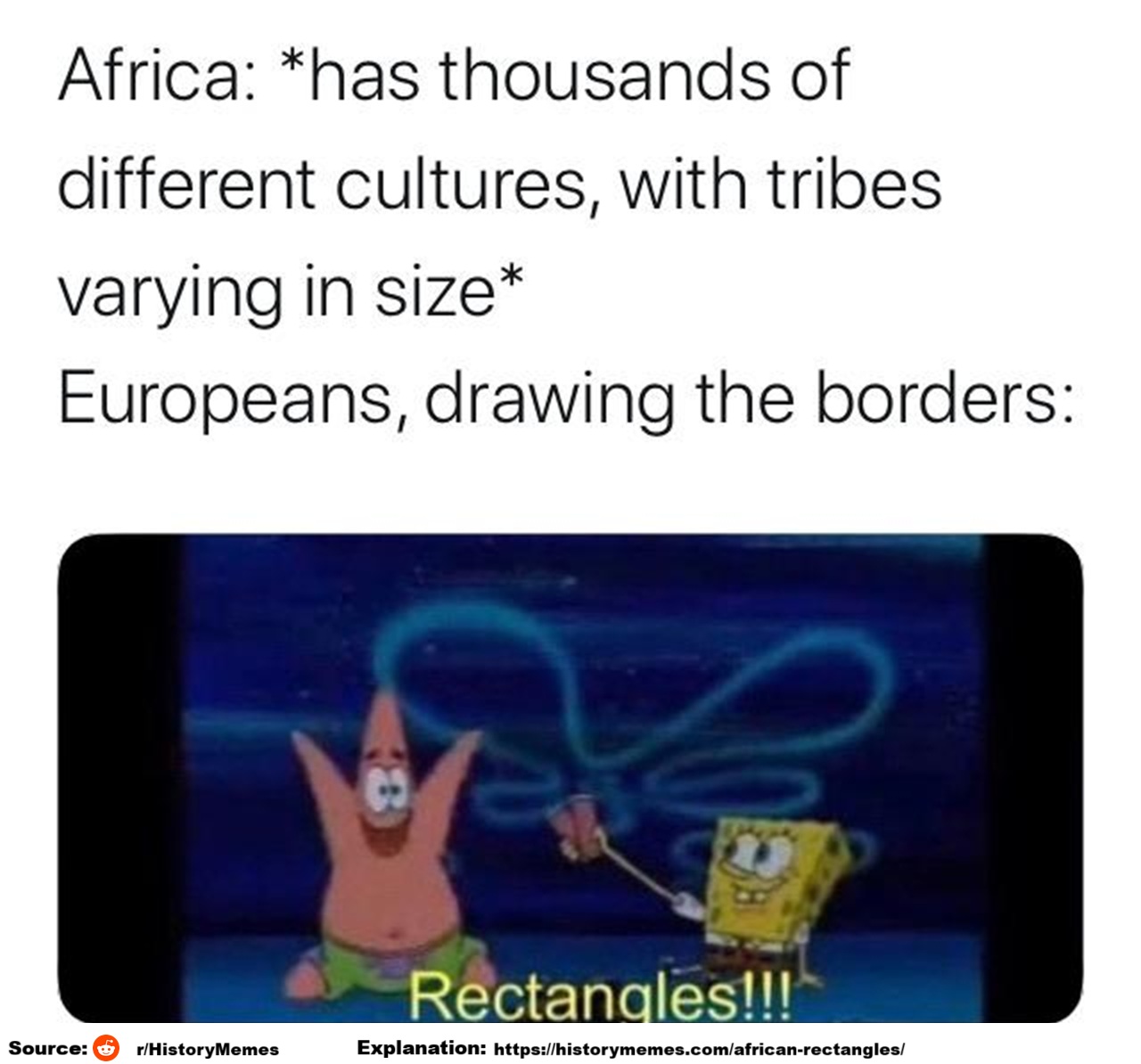
The meme humorously criticizes how European colonial powers divided up Africa during the late 19th century, particularly during the Berlin Conference (1884–1885), with little regard for the continent’s ethnic, cultural, or linguistic diversity.
Heres’ the text:
Africa: *has thousands of different cultures, with tribes varying in size
Europeans, drawing the borders:
Rectangles!!!
Colonial Borders in Africa
The Berlin Conference (1884–1885):
European powers: including Britain, France, Germany, Portugal, and Belgium, met to divide Africa into territories they could colonize. No African representatives were invited or consulted.
Artificial Boundaries:
Borders were drawn using:
- Lines of latitude and longitude
- Rivers or geometric shapes rather than existing tribal, linguistic, or cultural divisions.
Consequences:
- Ethnic divisions: Groups that had lived together were separated into different colonies (e.g., the Somali people split among five territories).
- Forced unity: Different and sometimes rival ethnic groups were grouped into a single colony (e.g., Nigeria includes Hausa, Yoruba, Igbo, and many others).
- Conflict: These arbitrary divisions sowed seeds for post-independence civil wars and tensions, as modern African nations inherited these colonial borders.
Lasting Impact:
Even after independence (mostly 1950s-1970s), most African states kept the colonial borders to avoid further chaos.
However, disputes and ethnic conflicts in countries like Sudan, Nigeria, the Democratic Republic of Congo, and Rwanda can trace roots to colonial-era boundary-making.
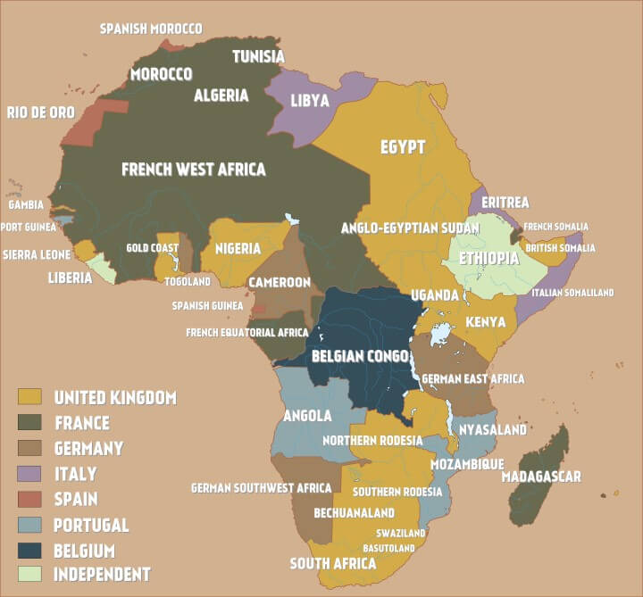
Here’s what the continent looked like in 1880 (5 years before the conference):

and heres’ what it looked like on the eve of World War 1 in 1914
And finally here’s what Europe might have looked like if the process had been reversed:

Books about how European powers drew borders in Africa and other places:
Leave a Reply